eDNA as a tool for measuring effectiveness of riparian restoration
Where terrestrial and aquatic systems meet, riparian zones form an important boundary around water bodies that are essential for supporting diverse biodiversity.
These areas are of great interest to environmental and catchment managers, as they undertake work to maintain healthy riparian zones. We want to highlight how eDNA can be used as an effective tool to help measure or guide these restoration activities.
Riparian zones
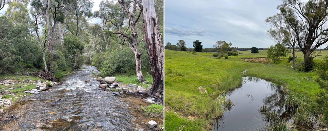
Riparian zones refer to the land along waterways such as creeks, streams, rivers and wetlands. Ideally, they are fertile areas that support a diverse range of floral and faunal communities, such as trees, plants, shrubs, algae and native wildlife.
The benefits of well managed zones are abundant. Healthy land supports healthy waterways, as the vegetation filters the nutrients and sediment out of run-off that enters waterways. Trees and plants also stabilise banks by their roots binding to sediment, reducing soil erosion and flood damage.
Trees and vegetation provide habitat and food for aquatic species such as fish, turtles and frogs, as well as semi-aquatic and terrestrial species. Habitat that also creates migration corridors to support wildlife movement, whilst shade from trees regulates water temperature.
Riparian zones even help in ways we cannot directly see, such as oxygenating waterways and storing carbon. They assist with nutrient cycling, a process when inorganic matter moves through organisms and returns to the environment. This provides key elements to food webs such as nitrogen and phosphorus.
Slippery slope of degradation
For many reasons, there is real value in protecting these zones to help support ecosystems and biodiversity. However, there are several factors that make this a difficult task.
Riparian vegetation is often under threat by agricultural activities due to access of stock that crushes plants and shrubs, over grazing and waste caused by cows and sheep pollutes the environment. Pesticides and fertilizers also influence riparian zones.
Invasion of weeds, pests and other feral species also increases the loss of vegetation. Humans also pose a significant threat by overuse of recreational activities around waterways, and most significantly, by extensive land clearing for urban development or agricultural purposes.
Restoration efforts
These threats have led to significant loss of riparian zones all over Australia. However, waterway strategies and government-funded action plans are in place to repair some of the damage.
On-ground activities are often undertaken by landholders, environmental and catchment managers, or volunteers. These include fence building, tree planting, modification of water flow, removal of weeds or invasive species and improving layered vegetation growth by ensuring ground cover, understorey and canopy.
These activities can be laborious, costly and time-consuming, but they are crucial for restoring the healthy balance of waterways and land. This is where eDNA can be utilised as a tool for measuring and ensuring the success of such efforts.
How eDNA can help
We know vegetation is important, but how much is enough? How far do the benefits extend? And where can we target rehabilitation works for the most impact? These are important questions when undertaking restoration works, and ones that we help to answer by measuring the impact on biodiversity.
eDNA biodiversity data can correlate with riparian health to inform or measure restoration works. Using eDNA metabarcoding, we can detect all species from a taxonomic group (e.g. fish, decapods, amphibians, vertebrates etc), and measure aquatic biodiversity in these areas to determine beneficial impact.
For example, North Central CMA’s eDNA project in the Tullaroop Catchment was part of an overarching restoration plan to create a healthy riparian corridor along Birch’s and Tullaroop Creeks. Works were undertaken to improve populations of species such as river blackfish and platypuses and water quality for the reservoir, Maryborough’s drinking water supply.
Data obtained from the 2021 sampling saw that site occupancy has increased for both species in the six-years between eDNA surveys. In 2015/16 platypuses were detected at 69% of the sites sampled. In 2021, this increased to 92% of sites returning a positive result. In 2015/16, river blackfish were detected at 42% of sites, and in 2021 this increased to 56%.
This was a great result for North Central CMA to quantify their restoration plan success, and highlights the importance of having baseline species or biodiversity data to measure potential growth or loss of biodiversity.
Continued monitoring
An extensive riparian monitoring program is now being undertaken by East Gippsland Landcare Network focusing on 4 main river systems in East Gippsland -Tambo, Nicholson, Mitchell, and Buchan.
Water sampling has been conducted over an extended area of 120 sites that represent good, moderate, and poor riparian health based on key criteria such as riparian vegetation, stock exclusion and bank erosion.
Continued eDNA monitoring measuring riparian health and restoration will help refine management actions. We are excited by the potential outcomes of these projects and will continue to share results when available.
If you have any questions or want to find out further information, please get in touch.
Acknowledgements
North Central CMA project was delivered through Victorian Government and partner agency investment into the Tullaroop Catchment Restoration project, guided by the Tullaroop Integrated Catchment Management Plan.
The East Gippsland project is being undertaken with the East Gippsland Landcare Network and funding from Landcare Australia.
Author: Jacquie Murphy, Communication Officer

